
Escape to the great outdoors on the Capitol Corridor train! In celebration of Earth Day, we’re highlighting some of the urban trails along our route. Here are our top picks for destination trails that can be accessed from Capitol Corridor stations.
Ohlone Greenway: Berkeley
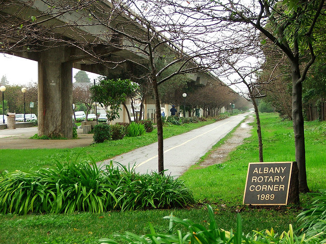
The Ohlone Greenway is a pedestrian and bicycle path that begins in North Berkeley and ends at Baxter Creek Gateway Park in Richmond. Just over five miles in length, the Greenway runs through the cities of Albany and El Cerrito and has dedicated lanes for pedestrians and bicyclists. The Greenway also intersects various parks and recreation areas, as well as local shopping and dining destinations like Gilman St. and Solano Ave. This paved, flat path is perfect for all ages and levels of fitness and offers views of the East Bay’s beautiful hills. The Greenway is accessible from the Berkeley Station, just over a mile away. Or, you can connect to BART at the Richmond Station or Oakland Jack London Station and get off at the North Berkeley or El Cerrito stops, which are located right on the path. To learn more about the Greenway, visit its trail link page.
San Francisco Bay Trail: Richmond, Berkeley, Emeryville, Oakland, Hayward, San Francisco, and Santa Clara
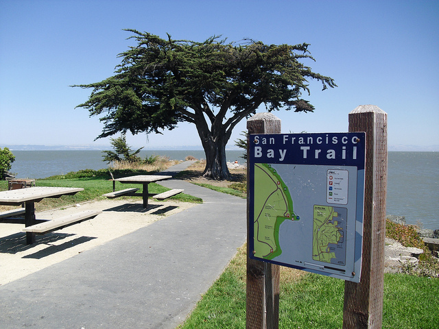
The San Francisco Bay Trail is a planned, 500-mile trail around the San Francisco Bay, and will encompass 47 cities in nine counties upon completion. There are 345 miles of the trail already in place at a variety of locations along the Bayfront and surrounding areas. With a mix of paved and natural surfaces, the trail provides a scenic route that walkers, cyclists, runners, skaters, and everyone in between can enjoy. Highlights of the trail include Crissy Field in San Francisco, Cesar Chavez Park in Berkeley, Middle Harbor Shoreline Park in Oakland, and the Point Isabel Regional Shoreline in Richmond. To learn more about the trail and view maps, visit the Bay Trail website. The trail can be accessed from a number of Capitol Corridor stations in the Bay Area, with direct access from the Berkeley Station, Emeryville Station, Oakland Jack London Station, and Santa Clara-Great America Station.
UC Davis Arboretum Trail: Davis
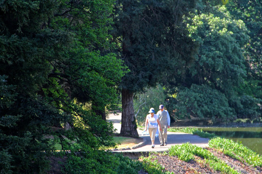
Nestled in the heart of the UC campus, the Arboretum Trail provides a tranquil haven within the lively college town of Davis. The scenic, three-mile trail loops through the UC Davis Arboretum and alongside the Putah Creek and connecting pond. With its 100 acres of gardens, the Arboretum is teeming with flora and fauna, including 31,000 trees and plants. Among the unique attractions are a Redwood grove, a Native American Contemplative Garden, and an Australian plant collection. The trail accommodates all skill levels, and is great for walking, running, and road biking. The Arboretum is free and open seven days a week, year-round. To get to the trail, take the train to the Davis Station, which is just over half a mile from the eastern entrance to the Arboretum. Follow 1st St. west from the station, turn left onto the pathway that begins at the E St. intersection, and continue along this pathway until you reach the Arboretum.
San Tomas Aquino Creek Trail: Santa Clara
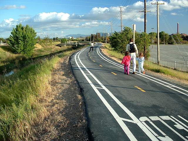
Completed in 2009, the San Tomas Aquino Creek (STA) Trail runs through Santa Clara along the creek with the same name. This paved, multi-use trail is just under eight miles total and provides spacious lanes for safe travel in both directions. With protection from adjacent roadways by barriers, the trail is perfect for bicyclists, runners, walkers, and rollerbladers. Its flat terrain makes it appropriate for all levels of fitness. Everyone will enjoy the beauty of the surrounding natural scenery and landscaping. The trail is also a major commuter route and feeder to the San Francisco Bay Trail and can be accessed from the Santa Clara-Great America Station. To get there from the station, head West on Stars and Stripes Dr. and past the north side of the Tasman Parking Garage and south side of the Santa Clara Golf and Tennis club. This route leads to a bridge connecting to the trail.
American River Parkway: Sacramento
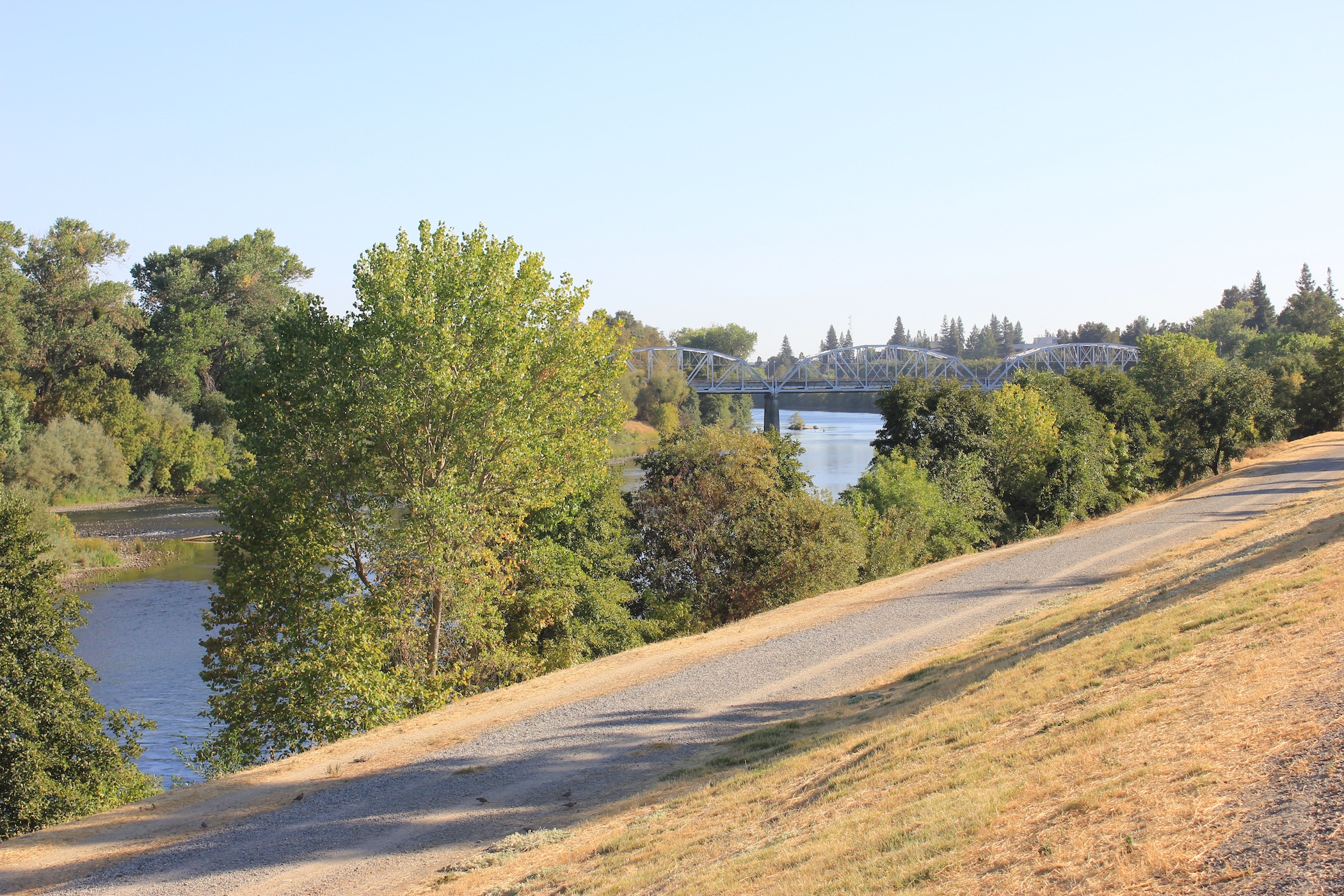
Widely regarded as the “jewel of Sacramento,” the American River Parkway connects 15 regional parks across 4,900 acres in the greater Sacramento area. The 23-mile parkway runs along the American River and through the cities of Sacramento, Rancho Cordova, Fair Oaks, and Folsom. Bordered by the Sacramento River in the west and the Folsom Reservoir in the east, the parkway provides access to hiking, biking, and equestrian trails; picnic areas; golf courses; wildlife viewing; fishing, boating, and rafting areas; campsites; and more. Highlights along the parkway include a connection to the 32-mile Jedediah Smith Memorial Trail, which was voted the #1 bike path on Trails.com in 2006; the 396-acre Ancil Hoffman Park, which is home to a golf course and nature center; and Paradise Beach, a cove on the American River that is popular for swimming. The parkway can be accessed from the Sacramento River Bike Trail, which is less than half a mile from the Sacramento Station. Head west on I St. towards the Sacramento River, and you will reach the trailhead at the intersection of Front St. and I St. To get to the parkway, follow the Sacramento River Bike Trail up to and across the Jibbon St. Bridge. Alternatively, you can continue along the Two Rivers Trail on the south side of the American River.
Grizzly Island Trail: Suisun
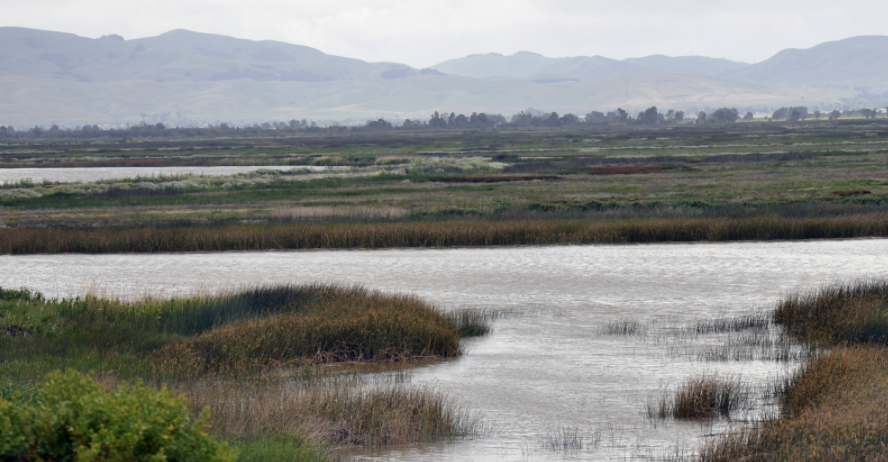
For some fresh air and prime wildlife viewing, head to Suisun’s Grizzly Island Trail. Adjacent to the nation’s largest contiguous estuarine marsh, Suisun is the gateway to a scenic network of marshlands teeming with native species, including river otters, tule elk, and 200 species of wetland birds. The product of a Safe Routes to School project, the pedestrian and bike-friendly Grizzly Island Trail offers the perfect opportunity to take in the natural beauty of this unique habitat. The paved, mile-long trail opened in May 2013 and features benches, informational signs about the surrounding marshlands, and wildlife viewing. Afterward, you can explore quaint Suisun City or enjoy lunch along the water at one of the great local restaurants. To get to the trail, take the train to the Suisun/Fairfield Station and proceed to the Central County Bikeway to the left of the parking lot. Follow the bikeway for about half a mile, cross Route 12 at the stoplight, and you’re there. You can’t miss the entrance to the trail, which is marked by a large granite sign.