When traveling, a common question riders ask is, “Where’s my train?” Whether trains are 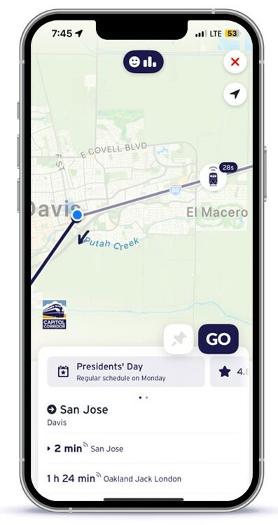 on schedule or delayed, riders need up-to-date status information to be reassured of a smooth journey, or, in the event of a delay, to make alternative travel plans.
Recently, Capitol Corridor took a big leap forward in helping riders get the train status information they need, right where they are. By making real-time train status available on third-party travel planning mobile apps that show live train location on a map as well as ETAs for upcoming train stations, riders get the information they need right at their fingertips. Apps that now show Capitol Corridor live status include: Transit App, Moovit, and Google Maps.
This latest enhancement is a result of our California Passenger Information Display System (CalPIDS) Modernization project, resulting in future station 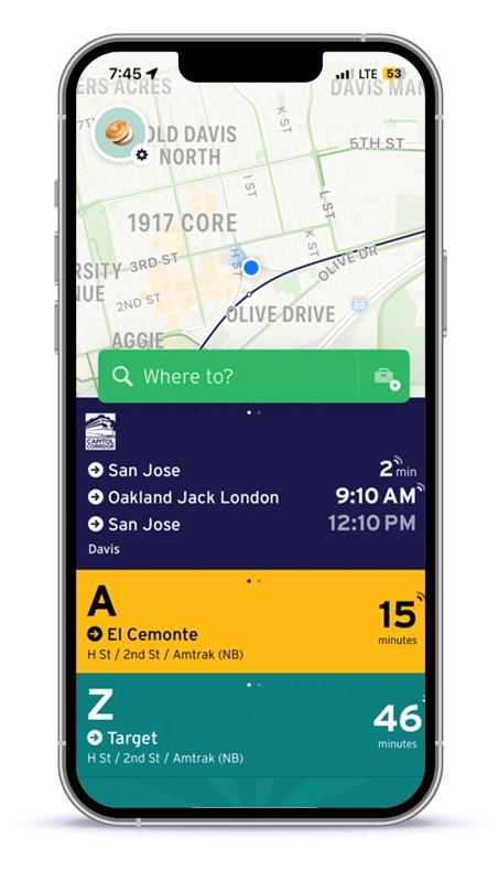 platform sign updates. As part of this project, Capitol Corridor launched real time train information via GTFS Realtime feeds that are available to app developers via 511 San Francisco Bay’s Open Data Portal, which serves as a central depository and distributor of transit data within the San Francisco Bay Area. GTFS Realtime is an extension to GTFS, an open data format for public transportation schedules and associated geographic information.
You can find more information on GTFS Transit and our Developer Resources page.
Capitol Corridor riders are sure to find the new train location and ETA information helpful for their journeys. Please note that the initial GTFS-Realtime feeds do not include connecting bus information or service alerts at this time, but these will be added as new GTFS Realtime feeds in the future.